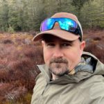
Luke Newey has over 15 years of experience in Geographic Information Systems (GIS) and Remote Sensing, working in precision agriculture and environmental science.
Luke has a diverse blend of skills including technical abilities in spatial data analytics, imagery classification & cartography. He has hands-on practical experience on farms, which includes UAV crop monitoring, soil sampling, ecological surveys and vegetation mapping. His expertise includes spatial data and imagery analysis for precision agriculture practices and environmental regulation & compliance. Luke has past experience working with a large precision agriculture service provider in Canada, land rehabilitation projects in Queensland, and conservation & vegetation mapping in Tasmania.
Luke is a member of the soil carbon team at Select Carbon delivering GIS & remote sensing services to the team, and supporting projects advancing nature-based solutions for soil carbon sequestration.
His interests include agriculture technologies and conservation biology with a focus on how to protect and restore biodiversity.
Qualifications:
Bachelor of Science (Ecology & Conservation Biology) from Griffith University
Graduate Certificate (GIS) from University of Tasmania
Master’s Degree with Distinction (GIS & Remote Sensing) from Charles Sturt University

